

Above is an insolation map for South America showing the estimated daily and yearly solar energy available for energy applications, including solar PV.
Insolation (also known as sun-hours) is the measurement of cumulative solar energy that reaches an area (in this case kWh per square meter) over a period of time. Irradiance is the measurement of instantaneous solar energy that reaches an area (typically Watts per square meter). You can think of insolation as energy and irradiance as power.
Below is a solar map for South America showing the estimated potential daily and yearly power generation per 1kW of peak grid-connected solar panels.
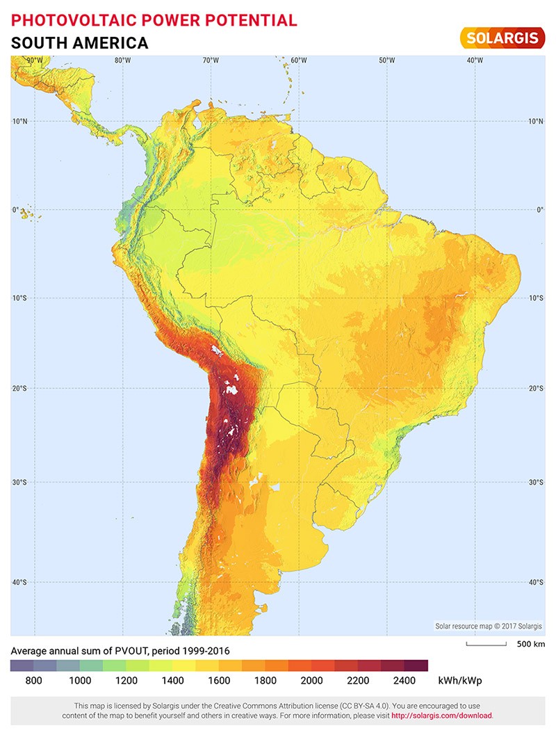
Maps obtained from the Global Solar Atlas 2.0, a free, web-based application is developed and operated by the company Solargis s.r.o. on behalf of the World Bank Group, utilizing Solargis data, with funding provided by the Energy Sector Management Assistance Program (ESMAP). For additional information: https://globalsolaratlas.info